Have you ever wondered how your phone knows the exact route to a new destination, down to the very street and turn? Or how a food delivery app can show you your order moving across the city in real time? The answer is a remarkable technology called the Global Positioning System, or GPS. It's a tool so seamlessly woven into our lives that we often forget the incredible science working behind that little dot on the map.
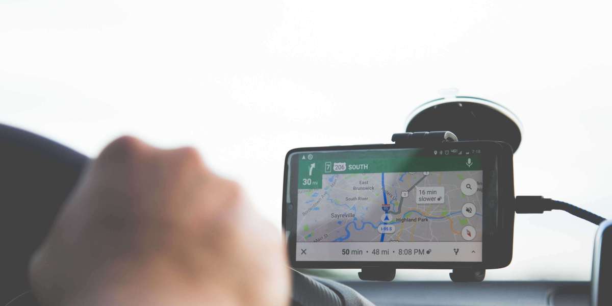
This is the very definition of what is gps navigation: the process of using satellite data to determine your position and guide you from one point to another. The app uses this continuous stream of location information to give you turn-by-turn directions, estimate your arrival time, and even reroute you around traffic jams.
If you've ever felt a bit puzzled by how it all works, you're in the right place. This guide will walk you through the basics of GPS navigation in simple terms. We will cover what it is, how it finds you, and how it’s used in ways you might not expect.
What Exactly is GPS?
GPS stands for Global Positioning System. At its core, it's a satellite-based system owned by the U.S. government that provides location and time information anywhere on or near the Earth. While it was originally developed for military use, it was made available for everyone in the 1980s. Now, anyone with a GPS receiver can use it for free.
Think of it as a massive, invisible grid that covers the entire globe. This grid is maintained by three key parts working together:
- Satellites: A network of about 30 satellites orbits the Earth at a very high altitude. They continuously send out signals.
- Ground Stations: These are control centers on Earth that monitor the satellites, ensuring they are healthy, in the correct orbit, and running perfectly.
- Receivers: This is the device in your hand or car—your smartphone, your vehicle’s navigation system, or a handheld GPS unit. Its job is to listen for the signals from the satellites.
These three components work in perfect sync to give you the precise location data you rely on every day.
How Your Phone Finds Its Location
The magic behind GPS is a concept called trilateration. It sounds complex, but the idea is quite simple. Your device figures out its position by measuring its distance from several satellites at once.
Step 1: Listening for a Whisper from Space
Each of the 30 GPS satellites constantly broadcasts a radio signal. This isn't just a random beep; the signal contains specific information: which satellite it is and the exact time the signal was sent. Your GPS receiver—the tiny chip in your phone—is designed to pick up these faint signals.
Step 2: Measuring Distance with Time
Once your receiver gets a signal, it notes the time it arrived. Because the signal travels at the speed of light (a known constant), your device can calculate its distance from that satellite. It does this using a simple formula:
Distance = Speed of Light x (Time Signal Arrived - Time Signal Was Sent)
If it took a fraction of a second for the signal to reach you, your phone translates that tiny delay into a distance in miles or kilometers.
Step 3: Pinpointing Your Spot on the Map
Now, your receiver repeats this process with other satellites.
- With one satellite, your device knows it is, say, 12,000 miles away. This means you could be anywhere on a giant, imaginary sphere around that satellite.
- With a second satellite, it finds another distance, creating a second sphere. Your location is now narrowed down to the circle where the two spheres overlap.
- With a third satellite, you get a third sphere. The intersection of all three spheres leaves only two possible points for your location. Your device can usually discard one point because it’s an impossible location (like thousands of miles up in space).
So, three satellites give you your position. But for the best accuracy, a fourth satellite is needed. This fourth signal helps correct any timing errors in your phone's clock, which isn't as perfect as the atomic clocks on the satellites. This correction ensures your location is accurate to within a few feet.
Making Sense of the Data
Your phone’s GPS receiver now has your coordinates (latitude and longitude). But numbers alone aren't very helpful. This is where your mapping app, like Google Maps or Apple Maps, comes in. The app takes those raw coordinates and places them as a dot on a digital map. As you move, your receiver constantly updates your position, and the app moves the dot along with you.
More Than Just Directions
While we mostly associate GPS with getting from A to B, its applications are incredibly diverse and touch almost every part of modern life.
Transportation and Delivery
GPS is the backbone of the global logistics industry. Shipping companies track vessels at sea, airlines navigate flight paths, and delivery services optimize routes to get your packages to you faster. Ride-sharing apps couldn't exist without it.
Emergency and Safety Services
When you call for help, GPS provides your location to dispatchers so that police, fire, or medical teams can find you quickly. It's also a vital safety tool for hikers and adventurers exploring remote areas.
Construction and Engineering
For large-scale building projects, precision is everything. GPS is used to survey land and guide heavy machinery with centimeter-level accuracy. This ensures that roads are graded correctly and buildings are constructed exactly according to plan. In complex projects like the development of modern air travel hubs, the specialized field of Aviation engineering Qatar uses advanced GPS to align runways, map out taxiways, and manage construction across vast areas with incredible precision.
Farming and Science
In agriculture, GPS guides tractors to plant seeds and apply fertilizer with minimal waste, a practice called "precision farming." Scientists also use GPS to monitor everything from volcanic activity and tectonic plate shifts to animal migration patterns.
Conclusion
GPS navigation is a powerful tool that has truly changed how we see and interact with the world. What was once cutting-edge military technology is now a free, accessible utility that helps us explore, stay safe, and connect with places both near and far.
The next time you follow that blue dot on your screen, take a moment to appreciate the amazing system behind it—a silent network of satellites, ground stations, and receivers all working together just to help you find your way.